Hong Kong !!
-
Originally posted by Just_do_it_lah:
from your mm2 .. thanks for info...
and google -
Originally posted by bus555:
Hong Kong has 6 famous ferry terminal
Star Ferry
China Ferry Terminal
Kowloon City Ferry
Hung Hom Ferry
Kwun Tong Ferry
Tuen Mun Pier Head
anymore?Yeah.. one more... Hong Kong - Macau Ferry terminal

-
Originally posted by Just_do_it_lah:
Yeah.. one more... Hong Kong - Macau Ferry terminal

ah crap forgot.. thanks.. one more alsoCentral Ferry pier..
mostly the boat is from HKI to and from kowloon lol
-
Originally posted by bus555:
Hong Kong has 6 famous ferry terminal
Star Ferry
China Ferry Terminal
Kowloon City Ferry
Hung Hom Ferry
Kwun Tong Ferry
Tuen Mun Pier Head
anymore?
never go to kwun tong ferry b4.... where is it? -
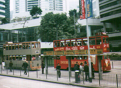
Hong Kong Tramways is a tram system in Hong Kong and one of the earliest forms of public transport in Hong Kong. Owned and operated by Veolia Transport – RATP Asia, the tramway runs on Hong Kong Island in Hong Kong between Shau Kei Wan and Kennedy Town, with a branch circulating Happy Valley. Each day 240,000 residents commute by tram. Trams in Hong Kong have not only been a form of transport for over 100 years, but also a major tourist attraction and one of the most environmentally friendly mass transit systems.
1902: Hong Kong Tramway Electric Company Ltd founded, and the name changed by the end of this year to Electric Traction Company of Hong Kong Ltd.
1910: Name of the company changed to The Hongkong Tramways Ltd.
1925: Enclosed double-decker trams replaced open-top trams.
1941: Japanese occupation took place. Very limited tram service was provided. Only 12 tramcars were in operation daily from Causeway Bay to Western Market.
1945: After three years and eight months of Japanese Occupation, all 109 tramcars still remained, but only 15 were operational. By October 1945, 40 tramcars were back in service.

2004: Tramways celebrates 100 years of service.
-
Star Ferry
The Star Ferry Company, Ltd., is a passenger ferry service operator in Hong Kong. Its principal routes carry passengers across Victoria Harbour, between Hong Kong Island and Kowloon. It was founded in 1888 as the Kowloon Ferry Company, adopting its present name in 1898.
The fleet of twelve ferries operates four routes across the harbour, carrying over 70,000 passengers a day, or 26 million a year. Even though there are now other ways to cross the harbour (by MTR and road tunnels), the Star Ferry continues to provide an efficient, popular and inexpensive mode of crossing the harbour. The company's main route runs between Central and Tsim Sha Tsui, which is what most people mean by "the Star Ferry" in common parlance.
This route continues to be popular with tourists, and has become one of the icons of Hong Kong heritage. The ferry itself, and the layout of the Kowloon pier are completely recognizable in the 1961 film The World of Suzie Wong. From the ferry, one can take in the famous view of the harbour and the Hong Kong skyline.

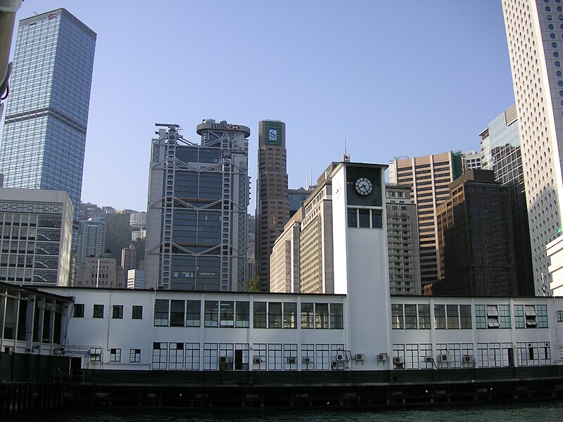
Tsim Sha Tsui Star Ferry Pier (above)
-
Central Pier
Star Ferry Pier, Central may refer to any of the successive generations of pier in Central, Hong Kong used by the Star Ferry for its services across Victoria Harbour to Hung Hom Pier. The current Star Ferry pier is in its 4th generation. It opened for public service on 12 November 2006.


-
Originally posted by I-like-flings(m):
never go to kwun tong ferry b4.... where is it?
Sad to say... i haven't contribute $ to star ferry yet... lol..
-
Victoria Harbour
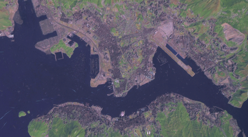
Victoria Harbour is a natural landform harbour situated between Hong Kong Island and the Kowloon Peninsula in Hong Kong. The harbour's deep, sheltered waters and strategic location on the South China Sea was instrumental in Hong Kong's establishment as a British colony and its subsequent development as a trading centre. Throughout its history, the harbour has seen numerous reclamation projects undertaken on both shores, but still retains its founding role as a port for thousands of international vessels each year.
Long famous for its spectacular views, the harbour is a major tourist attraction of Hong Kong. Lying in the middle of the territory's dense urban region, the harbour is the site of annual fireworks displays and its promenades are popular gathering places for tourists and residents.

The Victoria Harbour is world-famous for its stunning panoramic night view and skyline, particularly in the direction towards Hong Kong Island where the skyline of skyscrapers is superimposed over the ridges behind. Among the best places to view the Harbour is at the Victoria Tower on the Victoria Peak, or from the piazza at the Culture Centre or the promenade of Tsim Sha Tsui on the Kowloon side. Rides on the Star Ferry to view the harbour are also widely popular.
As the natural centre of the territory, the harbour has played host to many major public shows, including the annual fireworks displays on the second night of the Lunar New Year. These shows are popular with tourists and locals alike, and the show is usually telecast on local television. To add to the popularity of the harbour as a sightseeing location, the government introduced a show dubbed A Symphony of Lights, using use audio, lights and pyrotechnics to introduce the city to its viewers every evening.
Also recently opened, was the Avenue of Stars, built along the promenade outside the New World Centre in Tsim Sha Tsui. Modeled on the Hollywood Walk of Fame, it honours the most illustrious people the Hong Kong film industry has produced over the past decades.
By the end of November every year, the outer walls of buildings in the central business districts on both side of the harbours are dressed with Christmas-related decorations, and replaced with Lunar New Year-related ones by January.

-
Originally posted by Just_do_it_lah:
Sad to say... i haven't contribute $ to star ferry yet... lol..
go take ar.... very lomantic one... -
Port facilities
Victoria Harbour is home to most of the port facilities of Hong Kong, making Hong Kong amongst the world's busiest. An average of 220,000 ships visit the harbour each year, including both ocean going vessels and river vessels, for both goods and passengers. The Kwai Chung Container Terminals in the western part of the harbour is the main container handling facility, operating round the clock and handling about 62 percent of the 21,930 TEUs handled by the territory in 2004. Some 400 container liners serve Hong Kong weekly, connecting to over 500 destinations around the world.
For many years until 2004, Hong Kong handled the most containers (measured by TEUs), but it faces competition from the ports in nearby Shenzhen in recent years, with the ports in Shenzhen combined handling more containers than the Kwai Chung terminals since August 2004. Overall, the Hong Kong port has also lost out to the Port of Singapore in containers handled, with Singapore's port outpacing Hong Kong's since the first quarter of 2005.
-
Originally posted by I-like-flings(m):
go take ar.... very lomantic one...
lol... you take with lover... sure lomantic ... -
Transport (across Victoria Harbour)
There is no bridge crossing the harbour, but there are three cross-harbour tunnels: Cross Harbour Tunnel (opened 1972), Eastern Harbour Crossing (1989), and Western Harbour Crossing (1997). They connect Hong Kong Island and the Kowloon Peninsula across Victoria Harbour. The three tunnels act as important linkages between the Hong Kong Island and Kowloon.
Three MTR routes also have tunnels under the Harbour. They are namely:
- Tsuen Wan Line
- Tseung Kwan O Line (parallel with Eastern Harbour Crossing)
- Tung Chung Line and Airport Express, which share the same pair of tracks in the tunnel
The Star Ferry has been crossing the harbour since the late 1800s. The operated ferry routes today are: Central to Tsim Sha Tsui; Wanchai to Tsim Sha Tsui; Central to Hung Hom and Wan Chai to Hung Hom. Some other regular ferry services also operate in the harbour.
-
Originally posted by I-like-flings(m):
never go to kwun tong ferry b4.... where is it?Located at kwun tong lor and it near laguna city.. if from ur tai po area can take 74A from tai wo (not recommended cause very long) or 74X from tai po central to kwun tong ferry hehe
-
Originally posted by Just_do_it_lah:
lol... you take with lover... sure lomantic ...
no lah.. no chance to do that yet... the closest was..... when i went to the avenue of stars walk walk with one of my lover after attending the wedding dinner of my other lover lor.. sad sad sad... that place very lomantic too.. -
Yeah.. Ave of stars is a MUST VISIT place if you are in HK.....
something like walking along Esplanade Bridge...
Victoria Harbour has a great scenery... (especially when you are along Ave of Stars)... the skyscapers of HK island...
-
The Avenue of Stars (Chinese: 星光大�), modelled on the Hollywood Walk of Fame, is located along the Victoria Harbour waterfront in Tsim Sha Tsui, Hong Kong. It honours celebrities of the Hong Kong film industry.

Hand prints & autograph of HK Movie Director John Woo (above)
In 1982, the New World Group built a promenade along the waterfront around the New World Centre in Tsim Sha Tsui East, Kowloon. In 2003, the Group announced it would spend HK$40 million to build the Avenue of Stars, a project supported by the Hong Kong Tourism Board, Tourism Commission, the Leisure and Cultural Services Department of the Hong Kong government and the Hong Kong Film Awards Association.
The avenue was opened to the general public on 28 April 2004 with an opening ceremony held the previous day, 27 April. At opening, the avenue honours an initial 73 inductees elected by the Hong Kong Film Awards Association and the readers of City Entertainment.
(as at today, there are 101 hand prints & autograph at Ave of Stars)
-
Victoria Peak (traditional Chinese: 太平山, or previously- 扯旗山) is a mountain in Hong Kong. It is also known as Mount Austin, and locally as The Peak. The mountain is located in the western half of Hong Kong Island. With an altitude of 552 m (1,811 ft), it is the highest mountain on the island proper, but not in the entirety of Hong Kong, an honour which belongs to Tai Mo Shan.
The actual summit of Victoria Peak is occupied by a radio telecommunications facility and is closed to the public. However, the surrounding area of public parks and high-value residential land is the area that is normally meant by the name The Peak. It is a major tourist attraction which offers views over central Hong Kong, Victoria Harbour, and the surrounding islands.

As early as 19th century, the Peak attracted European, prominent residents because of its panoramic view over the colony and its temperate climate compared to the sub-tropical climate in the rest of Hong Kong. The sixth Governor of Hong Kong, Sir Richard MacDonnell had a summer residence built on the Peak circa 1868.[1]. Those that built houses named them whimsically, such as The Eyrie, and the Austin Arms. See First houses on the Peak
These original residents reached their homes by sedan chairs, which were carried up and down the steep slope of Victoria Peak. This limited development of the Peak until the opening of the Peak Tram funicular in 1888.
The boost to accessibility caused by the opening of the Peak Tram created demand for residences on the Peak. Between 1904 and 1930, the Peak Reservation Ordinance designated the Peak as an exclusive residential area reserved for non-Chinese. They also reserved the Peak Tram for the use of such passengers during peak periods. The Peak remains an upmarket residential area, although residency today is based on wealth.
-

-
With some seven million visitors every year, the Peak is a major tourist attraction of Hong Kong. It offers spectacular views of the city and its harbours. The number of visitors led to the construction of two major leisure and shopping centres, the Peak Tower and the Peak Galleria, situated adjacent to each other.
The Peak Tower incorporates the upper station of the Peak Tram, the funicular railway that brings passengers up from Hong Kong's Central district, whilst the Peak Galleria incorporates the bus station used by the Hong Kong public buses and green minibuses on the Peak. The Peak is also accessible by taxi and private car via the circuitous Peak Road, or by walking up the steep Old Peak Road from near the Zoological Botanical Gardens.

Victoria Peak Garden is located on the site of Mountain Lodge, the Governor's old summer residence, and is the closest publicly accessible point to the summit. It can be reached from Victoria Gap by walking up Mount Austin Road, a climb of about 150 metres (490 ft). Another popular walk is the level loop along Lugard Road, giving good views of Hong Kong's Central district and Kowloon, and then returning via Harlech Road, encircling the summit at the level of the Peak Tower.[3] There are several restaurants on Victoria Peak, most of which are located in the two shopping centres. However, the Peak Lookout Restaurant, is housed in an older and more traditional building which was originally a spacious house for engineers working on the Peak Tramway. It was rebuilt in 1901 as a stop area for sedan chairs, but was re-opened as a restaurant in 1947.
-

-

-
Lantau Peak or Fung Wong Shan (traditional Chinese: 鳳凰山, literally "Chinese Phoenix Mountain") is the second highest peak in Hong Kong. It is situated on Lantau Island, with a height of 934 m above sea level. It is most famous for the sunrise scenery viewed from the summit.
-
The Highest Peak in Hong Kong....
Tai Mo Shan (Chinese: 大帽山; pinyin: DàmàoshÄ�n / Dàmào ShÄ�n; Cantonese Yale: daai mo saan; literally "Big Hat Mountain"; also traditional Chinese: 大霧山; simplified Chinese: 大雾山; pinyin: DàwùshÄ�n / Dàwù ShÄ�n; Cantonese Yale: daai mo saan) has the highest peak in Hong Kong, with an altitude of 957 m. It is located approximately at the geographical centre of the New Territories.
The area surrounding Tai Mo Shan is a country park, which covers an area of 14.40 km² and adopts the same name - Tai Mo Shan Country Park. It is located to the north of Tai Lam Country Park.

Tai Mo Shan is made up of volcanic rocks of Jurassic age. The volcanic rocks are mainly coarse ash crystal tuff. To the northwest, the west and the south of the peak, the valleys contain large deposits of colluvium. The upper slopes are distinctly "ribbed", as is especially evident after a hill fire. These are stone terraces, running obliquely downhill to the valleys. It is also claimed to be Hong Kong's most misty area due to it being covered in clouds almost daily.


