Hong Kong !!
-
- New Territories taxi
The green taxis, the second most expensive, serve only parts of the New Territories, including Sai Kung, Tuen Mun, Yuen Long, Fanling, Sheung Shui, Ma On Shan, Tai Po, West of Ting Kau, North of Chuen Lung and North of CUHK, except Lantau Island, Tseung Kwan O, Sha Tin, Tsuen Wan, Kwai Chung and Tsing Yi. They are allowed to serve the taxi stands at Sha Tin Racecourse, Prince of Wales Hospital, Shun Lee Estate, Tseung Kwan O Hospital, Hang Hau Station, Tsing Yi Station and Tsuen Wan Station, which are designated interchange with red taxis. Although they serve the Airport and Disneyland, they do not serve Tung Chung and the rest of Lantau.
-
- Lantau taxi
The blue taxis run exclusively on southern Lantau Island, Tung Chung, the Airport and Disneyland, thus they are restricted to a small area. They are not quite as ubiquitous: there are only around 50 of them. There have been reports of some unofficial, unlicensed taxis in blue livery operating around these regions.

-
Lantau Island (also Lantao Island; Chinese: 大嶼山), based on the old local name of Lantau Peak (simplified Chinese: 烂头; traditional Chinese: 爛é ; pinyin: Làntóu; lit. Ragged Head), is the largest island in Hong Kong, located at the mouth of the Pearl River. Administratively, it is part of the Islands District, but a small part in the northeast of the island belongs to Tsuen Wan District. With the area of 147.16 km², it is the largest island in Hong Kong[1] and the sixth largest island in China. Originally the site of fishing villages, the island has in recent years been transformed with the development of several major infrastructure projects, including the new Hong Kong International Airport, Ngong Ping 360, and Hong Kong Disneyland

-
History of Lautau Island
Artifacts unearthed on the island show human activities dated back to the Neolithic Age and the Bronze Age. For instance, rock carvings at Shek Pik are thought to date back to the Bronze Age, while a stone circle at Fan Lau is probably from the Neolithic Age. Both sites are located on the southwestern coast of the island.
The island was known as Tai Hai Shan (大奚山) in the distant past. It was often shown in navigation maps because of its proximity to a major sea route in South China.
Like Cheung Chau, Lantau was once the base for pirates and smugglers, and was one of the bases of Cheung Po Tsai in the 19th century.
Lantau Island, together with Tuen Mun were among the first European trading settlements in the Pearl River area, established by Portuguese traders in the 1510s. The Portuguese abandoned these settlements around 1517, following defeat against Chinese troops (see Fernão Pires de Andrade). Later, the island became an important trading post for the British, long before they showed an interest for Hong Kong Island.
-
Geographical characteristics
Lantau Island consists mainly of mountainous terrain. With an area of approx. 146 km², it is the largest island in Hong Kong, and is almost twice the size of Hong Kong Island. Lantau Peak (934 m) is the highest point of the island. It is the second highest in Hong Kong, after Tai Mo Shan, and is almost twice the height of Victoria Peak. Lantau Island is often referred to as "the lungs of Hong Kong", because of its abundance of indigenous forest and relative scarcity of high-rise residential developments which characterise Hong Kong Island and Kowloon.
Population
Lantau Island has a relatively low population density, with 45,000 people living there, compared to 1.4 million on Hong Kong Island. Settlements are scattered all over the island and each has its own distinctive characteristic. The completion of the Hong Kong International Airport at Chek Lap Kok in 1998 has irrevocably changed north-western Lantau; the once quiet village of Tung Chung is now a new town, home to over 25,000 people in a number of 30 to 50 storey high-rise housing estates and condominiums located right next to the airport. Over the next few years, the population of the North Lantau New Town, on reclaimed land stretching from Tung Chung to Tai Ho is expected to increase to a target population of over 200,000, across 7.6 km² of land.
-
Tourist attractions @ Lautau Island
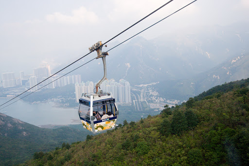
On Ngong Ping Plateau, where the Tian Tan Buddha (or "Giant Buddha"), an 85-foot-high bronze Buddha statue, various monastery buildings and a vegetarian restaurant can be found. Walkers can ascend from Tung Chung to the monastery in two hours. Visitors can also take a 25 minutes ride on Ngong Ping Cable Car from Tung Chung to Ngong Ping Plateau.
Ngong Ping 360 is a dynamic new tourism experience, which combines a 5.7 km cable car journey with a cultural themed village and easy access to the Tian Tan Buddha Statue, the world’s largest, seated, outdoor, bronze Buddha statue.


-
The Ngong Ping Cable Car travels between its Tung Chung and Ngong Ping Cable Car Terminals. It is a visually spectacular 25-minute experience providing panoramic views of the Tian Tan Buddha Statue, the flora and fauna of the beautiful North Lantau Country Park, Tung Chung Bay and the Hong Kong International Airport.


-
Hong Kong Disneyland lies on the northeastern part of the island, approximately two kilometres from Discovery Bay and opened on 12 September 2005, on a massive land reclamation project in Penny's Bay. The US$1.8 billion project includes a Disney theme park, two hotels and retail, dining and entertainment facilities stretching over 1.26 km² (310 acres); as well as its own rail network linking from Sunny Bay MTR station in Yam O.
-
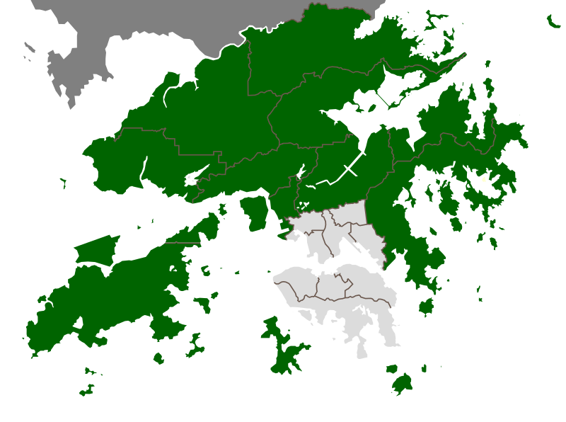
New Territories (abbreviated to NT or N.T.) is one of the three main regions of Hong Kong, alongside Hong Kong Island and the Kowloon peninsula. Historically, it is the region described in The Convention for the Extension of Hong Kong Territory. According to that the territories comprise the mainland area north of the Boundary Street of Kowloon Peninsula and south of the Sham Chun River which is the border between Hong Kong and Mainland China, as well as over 200 outlying Islands including Lantau Island, Lamma Island, Cheung Chau, and Peng Chau in the territory of Hong Kong.
Later, after New Kowloon was defined from the area between the Boundary Street and the Kowloon Ranges spanned from Lai Chi Kok to Lei Yue Mun, and the extension of the urban areas of Kowloon, New Kowloon was gradually urbanised and absorbed into Kowloon. In modern times New Kowloon is almost always considered part of Kowloon and instead of the New Territories – except statutorily.
Hence, the New Territories now comprises only the mainland north of the Kowloon Ranges and south of the Sham Chun River, as well as the Outlying Islands. It comprises an area of 952 km² (368 sq mi). Nevertheless, New Kowloon has remained statutorily part of the New Territories instead of Kowloon.

The New Territories were leased from Qing China to the United Kingdom in 1898 for 99 years in the Second Convention of Peking (The Convention for the Extension of Hong Kong Territory). Upon the expiration of the lease, sovereignty was transferred to People's Republic of China in 1997, together with the Qing ceded territories of Hong Kong Island and Kowloon Peninsula.
In 2006, New Territories had a population of 3,573,635 and its population density was 3,748 per km².
-
North District (traditional Chinese: 北�) is the northernmost district of the 18 districts of Hong Kong. It is located in the northwestern part of the New Territories. The new town of Fanling-Sheung Shui is within this district. It had a population of 298,657 in 2001. The district has the second lowest population density.
It borders with Shenzhen city with the Sham Chun River. Most major access points to Mainland China from Hong Kong lie in this district. The North District is about 168 km² in area.

-
Sai Kung District is the second largest district in Hong Kong in terms of area. It comprises the southern half of Sai Kung Peninsula in the New Territories plus a strip to the east of Kowloon. The administrative centre is Sai Kung Town but the district's population is concentrated in Tseung Kwan O New Town. The district has the second youngest residents.

-
Sha Tin District is one of the 18 districts of the Hong Kong Special Administrative Region of the People's Republic of China. One of the 9 districts located in the New Territories, it covers the areas of Sha Tin, Tai Wai, Ma On Shan, Fo Tan, Siu Lek Yuen and Ma Liu Shui (Ma Liu Shui is where The Chinese University of Hong Kong is located). The district has the highest population. According to the 2001 census, it had a population of 628,634 in 2001, including about 27,000 people living in 48 indigenous villages.

-
Tai Po District is one of the 18 districts of Hong Kong. It covers the areas of Tai Po, Tai Po Kau, Ting Kok, Plover Cove and the northern part of Sai Kung Peninsula on both shores of Tolo Channel. It is located in the New Territories.
Like Yuen Long, the area of Tai Po used to be a traditional market town. Tai Po New Town, developed around the area of Tai Po and on reclaimed lands on the estuaries of Lam Tsuen and Tai Po rivers. It had a population of 310,879 in 2001. The district has the third lowest population density.

-
Kwai Tsing (traditional Chinese: 葵é�’å�€; pinyin: KuíqÄ«ng QÅ« / Kuí-QÄ«ng QÅ«) is one of the 18 districts of Hong Kong. It consists of two parts - Kwai Chung and Tsing Yi Island. Kwai Tsing is part of the New Territories. It had a population of 477,092 in 2001. The district has the third least educated residents and their income is below average.
Kwai Tsing did not exist as a standalone district when Hong Kong's District Boards were formed in the early 1980s. It remained as a part of Tsuen Wan district until 1985. The newly created district was known as Kwai Chung and Tsing Yi District (葵涌��衣�) until 1988, when its name was shortened to Kwai Tsing District.
The internationally famous container terminals can be found within the district, along the shores of Rambler Channel between Kwai Chung and Tsing Yi Island. The Tsing Ma Bridge, leading to the Hong Kong International Airport through the North Lantau Highway, starts at the northwestern end of Tsing Yi Island.
Over 75% of the district residents live in public housing.

-
Tsuen Wan District (traditional Chinese: è�ƒç�£å�€; pinyin: QuánwÄ�n QÅ«) is one of the 18 districts of the Hong Kong Special Administrative Region of China. It is located in the New Territories and is served by the Tsuen Wan Line of the MTR metro system. It had a population of 275,527 in 2001. Its residents enjoy the highest income in the New Territories.
Tsuen Wan of the district is part of the Tsuen Wan New Town.

-
Tuen Mun District (traditional Chinese: 屯門å�€; pinyin: Túnmén QÅ«) is one of the 18 administrative districts of Hong Kong. Its name was 'Tsing Shan' before and it changed in the 1970s. It is the westernmost continental district of Hong Kong, located about 32 km from the Kowloon Peninsula, 7 km southwest of Yuen Long and 18 km west of Tsuen Wan. It had a population of 488,831 in 2001. Part of the district is the Tuen Mun New Town, which contains one of the largest residential areas in the New Territories. This district has the second least educated residents.

-
Yuen Long District (traditional Chinese: 元朗å�€, Jyutping: jyun4 long5, pinyin: YuánlÇŽng, used to be known as Un Long), is one of the districts of Hong Kong located in the northwest of the New Territories. It had a population of 449,070 in 2001. The district has the youngest population of Hong Kong and the lowest income in the New Territories.

-
The Islands District (traditional Chinese: 離島�) is one of the 18 districts of Hong Kong. It is part of the New Territories. It had a population of 86,667 in 2001.
Hong Kong consists of a peninsula and 236 islands. The Islands District consists of some twenty large and small islands which lie to the south and southwest of Hong Kong.
With an area that is 16% of Hong Kong and a population that is 2% of Hong Kong, the Islands District is the largest in terms of area and also the least populated. It is therefore the district with by far the lowest population density of 783 per km². The outlying islands are notable for a more relaxed way of life than that of Hong Kong Island and Kowloon Peninsula. The district has the third youngest residents.
Many islands of Hong Kong are actually not part of the district. Most notably, Hong Kong Island contains four districts itself. The term Outlying Islands tends to refer to the islands of the Islands District. The northeast point of Lantau and Ma Wan traditionally belong to Tsuen Wan District owing to their administration and transportation dependence of Tsuen Wan. Tsing Yi Island once was administrated by Tsuen Wan District and now by Kwai Tsing District. Whilst the Sai Kung Islands are part of the Sai Kung District, and the Tolo Channel Islands part of Tai Po District.
Tung Chung new town on the North Lantau near Hong Kong International Airport, Chek Lap Kok is a new generation of new town. Discovery Bay is a large private housing estate on East Lantau.
Collectively, Mui Wo and Tai O on Lantau, Cheung Chau, Lamma Island and Peng Chau are more populated than the rest of the area of the district.

-
Kowloon City District (traditional Chinese: ��城�) is one of the 18 districts of Hong Kong. It is located in Kowloon. It had a population of 381,352 in 2001. The district has the third most educated residents while its residents enjoy the highest income in Kowloon.
Kowloon City District is a relatively low density residential area.
Areas include: Ho Man Tin, Hung Hom, Kai Tak Airport, Kowloon Tong, Ma Tau Wai, To Kwa Wan, and Whampoa Garden, and the proper Kowloon City.


-
Kwun Tong (traditional Chinese: 觀塘�) is one of the 18 districts of Hong Kong. It is located in Kowloon. It had a population of 562,427 in 2001. The district has the third highest population while the income is below average.
It is the most densely populated district, with 55,000 per km², but it is also one of the largest industrial areas in Hong Kong. Pollution, poverty and aging population are the concerns. According to a statistical figures of 2001, the proportion of poor and elderly people in this district is 22.6% and 15.5% respectively. Besides, the number of poor people living in this district is 124,803, which is the highest in Hong Kong.

-
Sham Shui Po District (traditional Chinese: 深水埗�) is one of 18 districts of Hong Kong. It includes Sham Shui Po, Cheung Sha Wan and Lai Chi Kok of New Kowloon, and Stonecutter's Island of Kowloon. It is the poorest district in Hong Kong, with a predominantly working-class population of 365,540 and the lowest median household income, and the fourth least educated residents.

-
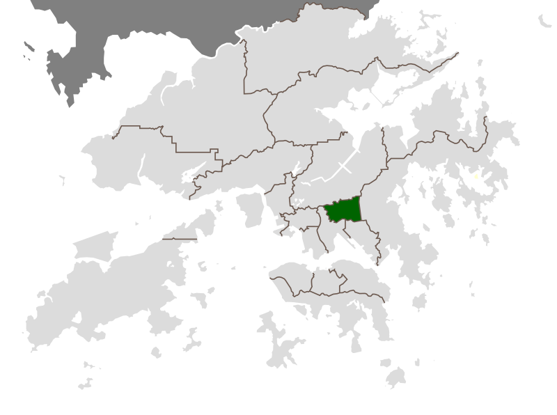
Wong Tai Sin District (traditional Chinese: 黃大仙�) is one of the 18 districts of Hong Kong, and is the only landlocked district of the city. It is located in Kowloon and has a population of 444,630 (2001 figures). The district has the least educated residents with the lowest income, the oldest residents and the second highest population density.
The district contains the areas of Diamond Hill, Wang Tau Hom, Lok Fu, Chuk Yuen, Wong Tai Sin, Tsz Wan Shan, Fung Wong, Choi Hung and Choi Wan, an area that includes several major public housing estates. Over 85% of the district's residents live in public-built housing.
The district derives its name from the Wong Tai Sin Temple, dedicated to Wong Tai Sin, which is located there.
The district is also the location of the Chi Lin Nunnery, built in the Tang Dynasty style, a popular tourist attraction.

-
Yau Tsim Mong District (traditional Chinese: 油尖旺å�€; pinyin: YóujiÄ�nwàng QÅ«, Jyutping: jau4 zim1 wong6 keoi1) is one of 18 districts of Hong Kong, located on western Kowloon peninsula. It is the core urban area of Kowloon. The district has the third highest population density of all districts. The 2006 By-Census recorded the total population of Yau Tsim Mong District at 280,548.
Formerly two districts, the Yau Tsim District and Mong Kok District, it was combined in 1994 as an acronym of three of its major areas: Yau Ma Tei, Tsim Sha Tsui, and Mong Kok.

-

-
East Kowloon

