The old MRT
-
I scanned this from some brochures. All pictures and texts aren't owned by me!
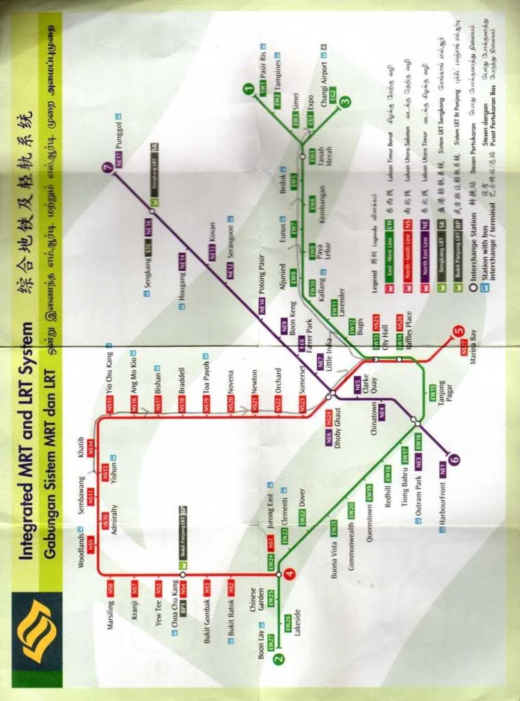
The very old map
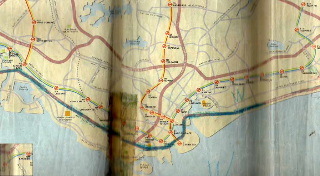
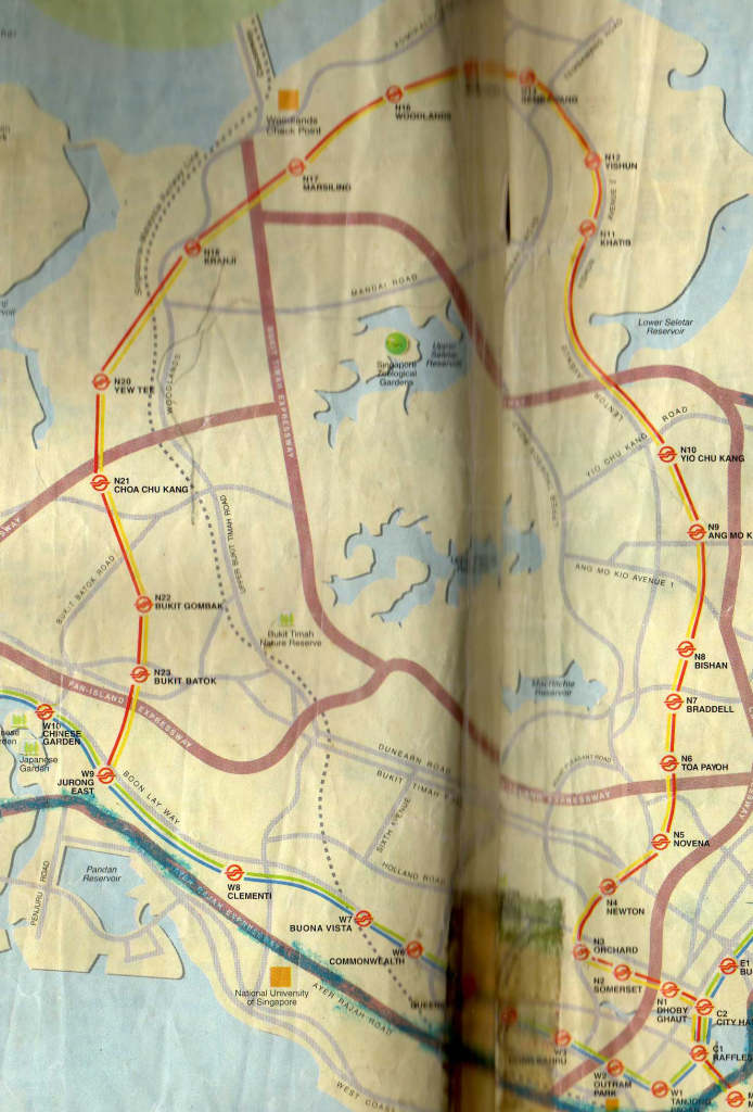
Newer map after this (Dover and CGA still unopened)
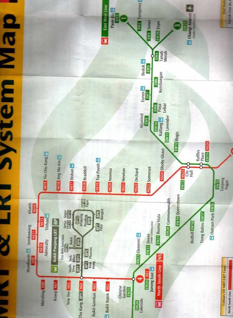
A newer map with CGA done, but Dover under construction
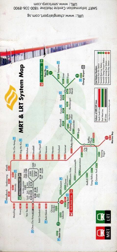
The map before BLE and CCL opened.
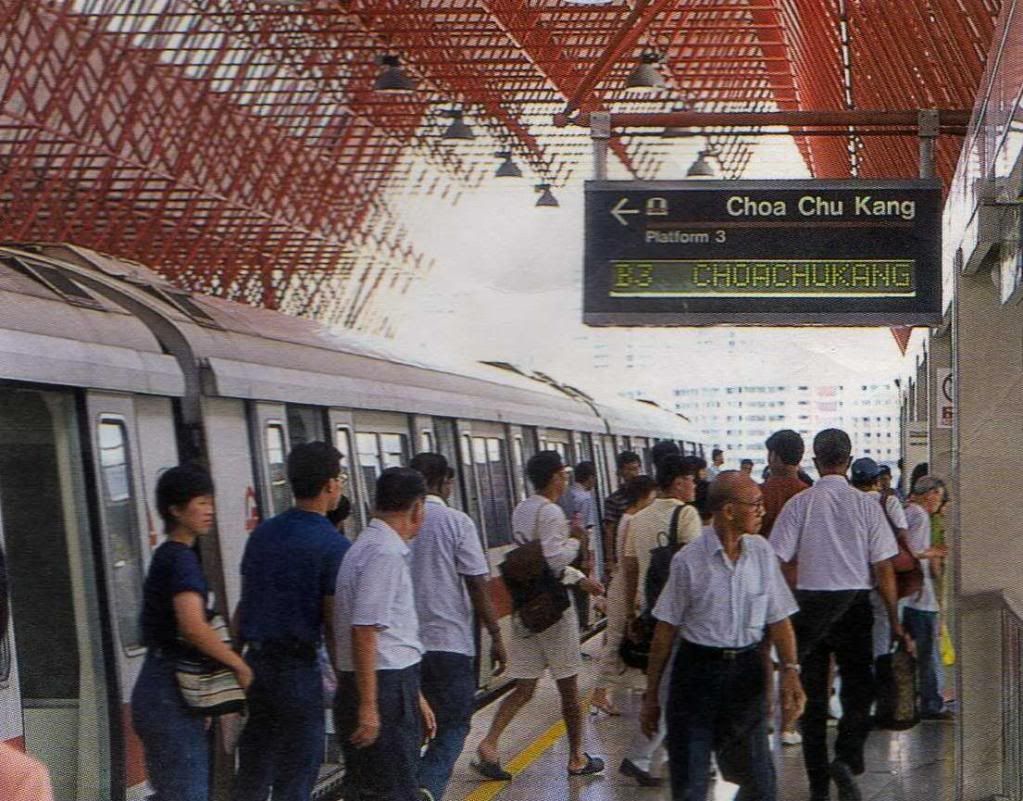
Middle platform of Jurong East without the Woodlands Extension
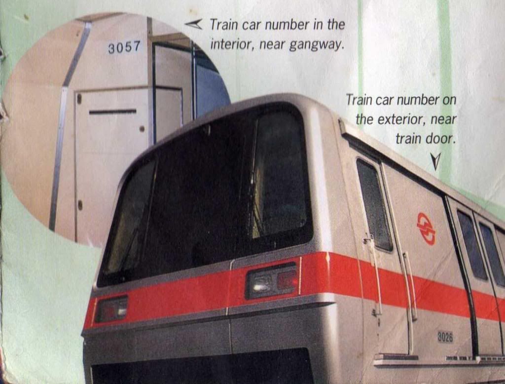
057/058 and 025/026 mentioned in a brochure
Old PSD labels
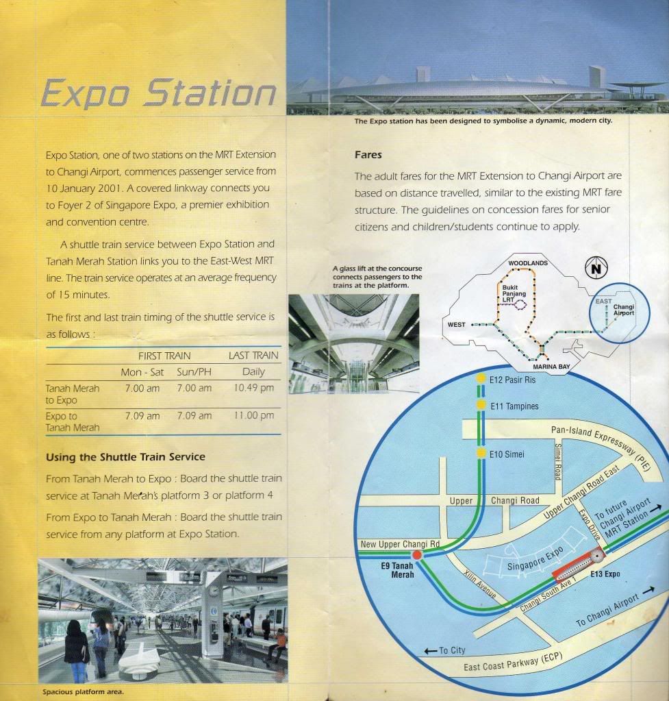
Introducing Expo Station
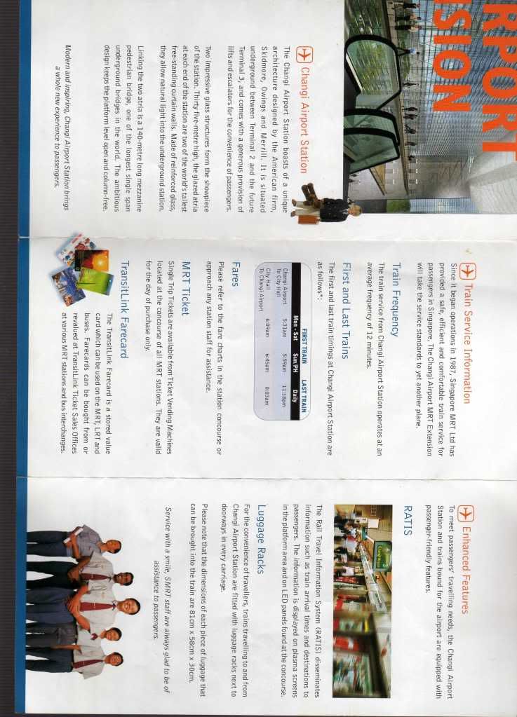
Introducing Changi Airport Station + RATIS
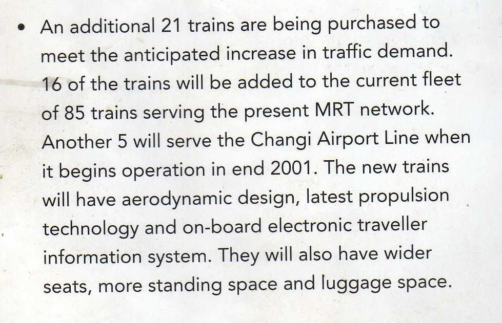
New trains being ordered, possibly being C751Bs
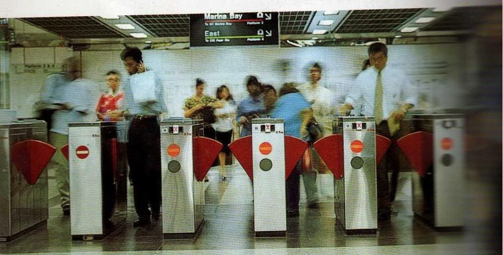
Old faregates
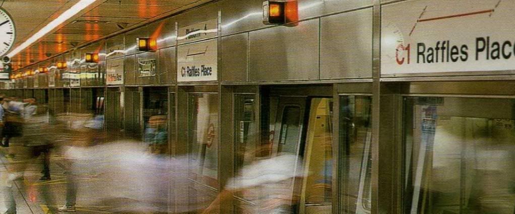
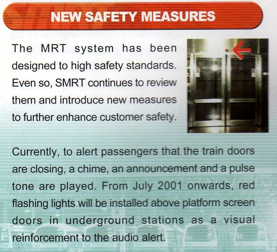
Introducing the PSD door closing warning light
-
beautiful. miss those times man. esp 1997 - 2003
-
I am only 14 so dun remember all this but I really can see how Singapore had changed over the past few years really heartening...
-
Which station is this? Hint: It's on the NSL.
No prize for correct answer :p
-
Originally posted by tranquilice:
Which station is this? Hint: It's on the NSL.
No prize for correct answer :p
Duno. I never went to NSL when i was really young.
-
Originally posted by tranquilice:
Which station is this? Hint: It's on the NSL.
No prize for correct answer :p
Newton??
-
Some pictures I booklet found in a drawer. Is was before MRT started running.
MRT map: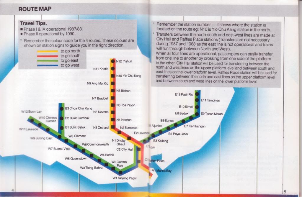
MRT Brochure (front):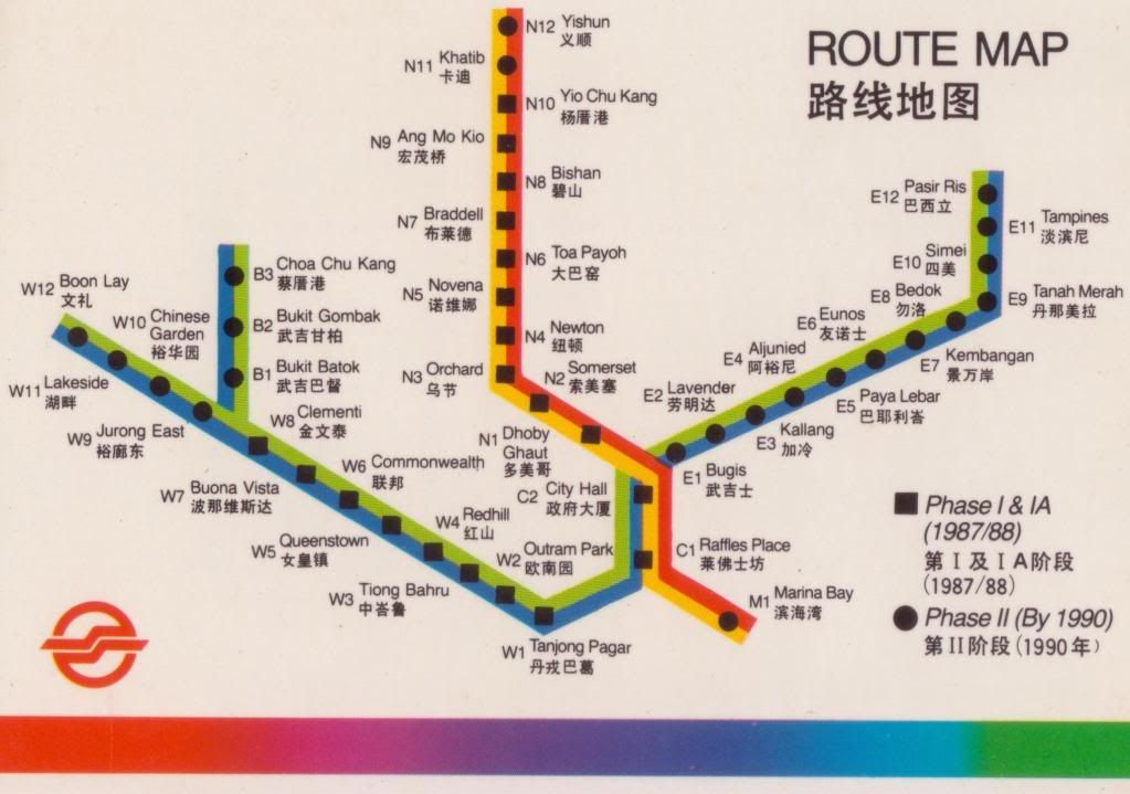
MRT Brochure (back):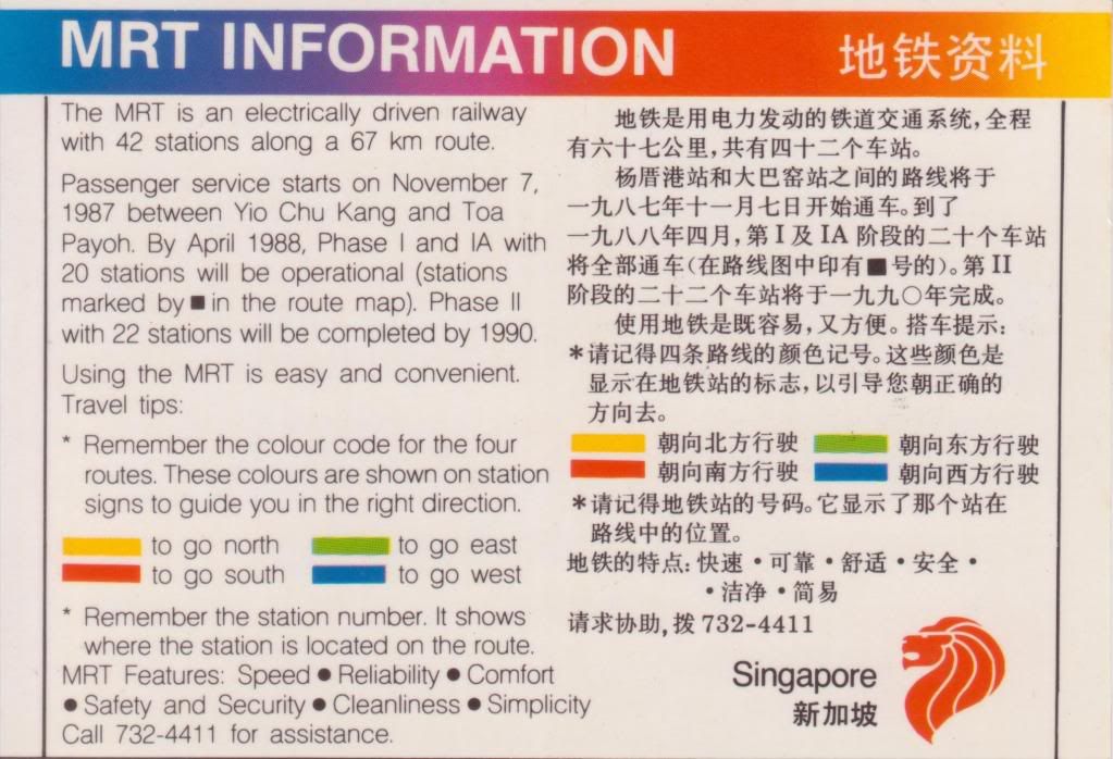
-
the pic, i guess is novena....before all the malls built up
-
Bishan ??
-
Its Novena, google will tell you that.

-
novena?
-
i can rmb from the overhead bridge
-
Originally posted by ^tamago^:
novena?
yep. it's novena. remember Tan Tock Seng? yes, that's the exit.
-
Originally posted by nenepokey:
yep. it's novena. remember Tan Tock Seng? yes, that's the exit.
The answer is Novena, but the exit in the photo should be the one near Thomson Rd. I don't remember seeing any overhead bridge outside the exit to TTSH. -
Originally posted by tvcnq:
Some pictures I booklet found in a drawer. Is was before MRT started running.
MRT map:
MRT Brochure (front):
MRT Brochure (back):
Lost it when I shifted form one part of Jurong to another part of Jurong...

-
Woah super old...Classic.
-
Originally posted by willis_chong:
I scanned this from some brochures. All pictures and texts aren't owned by me!
The very old map
Newer map after this (Dover and CGA still unopened)
A newer map with CGA done, but Dover under construction
The map before BLE and CCL opened.
Middle platform of Jurong East without the Woodlands Extension

Wow! Ends at CCK! Never seen this b4!
-
Originally posted by SMRT BUSES LuvER:
Wow! Ends at CCK! Never seen this b4!
Last time the NSL went only to Yishun, and the branch line from EWL starts from JUR to CCK. Then there's this WDL extension, connect CCK to YIS, then JUR to MRB become NSL.
-
Got picture of how last time, MRT carriages were not crowded during peak periods.
But now, it's like packed like sardines?

-
Originally posted by tvcnq:
Some pictures I booklet found in a drawer. Is was before MRT started running.
I remembered that when the branch line to Choa Chu Kang opened, the colour code was not green and blue but brown and orange instead.From Jurong East to Choa Chu Kang: Orange
From Choa Chu Kang to Jurong East: Brown
Now, orange is used again, for the Circle Line.
http://farm3.static.flickr.com/2318/2155522020_a764a317c9_o.png
-
Construction of the East-West and North-South line was no easy task. The tunneling work is an challenging task, cause before the tunnel can be built. The road have to be diverted to allow the construction of the tunnel and a very deep trench was excavated. The construction method for the tunnel was cut and cover.
Now, by using a TBM(Tunnel Boring Machine) it help to simplify the task.
-
Originally posted by shinkansen:
Construction of the East-West and North-South line was no easy task. The tunneling work is an challenging task, cause before the tunnel can be built. The road have to be diverted to allow the construction of the tunnel and a very deep trench was excavated. The construction method for the tunnel was cut and cover.
Now, by using a TBM(Tunnel Boring Machine) it help to simplify the task.
The most difficult were Raffles Place - City Hall that cross under the Singapore River and Raffles Place - Marina Bay that cross under the bay (later that part of the bay was reclaimed).NEL between Hougang and Punggol used the cut-and-cover method.
-
Cut-And-Over method?
How does it works? -
Last time the announcement was 'ting tong.. ting tong.. ting tong' without the 'doors are closing' and the 'toot toot toot toot toot'
-
Originally posted by Ajen:
Cut-And-Over method?
How does it works?
You can read about it here: http://en.wikipedia.org/wiki/Tunnel